GEOG 1000: Earth’s Surface Environments
 This course examines the interrelationships of land, water, and atmosphere in the human environment. Location of features and countries is also emphasized.
Geography 1000 E-Portfolio Assignment: Tracking Earthquakes and Volcanoes
Earthquakes
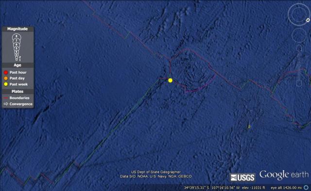
Magnitude: 5.3
Date and Time:
- Thursday, April 18, 2013 at 21:26:36 UTC
- Thursday, April 18, 2013 at 02:26:36 PM at epicenter
Location: 34.334°S, 109.178°W
Depth: 10.3 km (6.4 miles)
Tectonic Plate Boundary: Divergent Boundary “At a divergent boundary. magma from the asthenosphere wells up in the opening between plates…A divergent boundary is usually represented by a midocean ridge.” (Darell Hess, Physical Geography. 10th Edition, 2011)
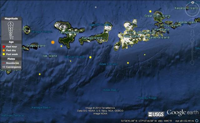
Magnitude: 5.7
Date and Time:
- Sunday, April 21, 2013 at 13:48:29 UTC
- Sunday, April 21, 2013 at 04:48:29 AM at epicenter
Location: 51.654°N, 178.246°W
Depth: 44 km (27.3 miles)
Tectonic Plate Boundary: Oceanic-Oceanic “If the convergent boundary is between two oceanic plates, subduction also takes place… With time, a volcanic islands arc (such as the Aleutain Islands and Mariana Islands) develops. ” (Darell Hess, Physical Geography. 10th Edition, 2011)
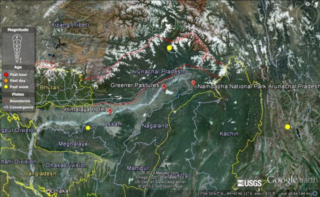
Magnitude: 5.3
Date and Time:
- Tuesday, April 16, 2013 at 08:34:12 UTC
- Tuesday, April 16, 2013 at 02:04:12 PM at epicenter
Location: 28.874°N, 95.115°E
Depth: 31.7 km (19.7 miles)
Tectonic Plate Boundary: Continental-Continental “Where there is a convergent boundary between two continental plates, no subduction takes place because continental crust is too buoyant to subduct. Instead huge mountain ranges… are built up. The most dramatic present day example of continental collision has resulted in the formation of the Himalayas. ” (Darell Hess, Physical Geography. 10th Edition, 2011)
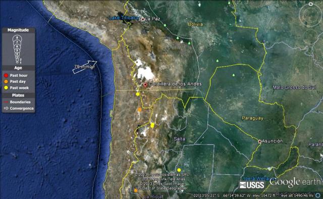
Magnitude: 4.2
Date and Time:
- Sunday, April 21, 2013 at 15:08:32 UTC
- Sunday, April 21, 2013 at 11:08:32 AM at epicenter
Location: 22.995°S, 68.100°W
Depth: 132 km (82.0 miles)
Tectonic Plate Boundary: Oceanic-Continental “Because oceanic lithosphere includes dense basaltic crust, it is denser than continental lithosphere, and so oceanic lithosphere always underrides continental lithosphere when the two collide…Wherever such a oceanic-continental boundary exists, a mountain range is formed on land (the Andes range in South America is a notable example) ” (Darell Hess, Physical Geography. 10th Edition, 2011)
Magnitude: 4.1
Date and Time:
- Wednesday, April 17, 2013 at 02:57:58 UTC
- Tuesday, April 16, 2013 at 07:57:58 PM at epicenter
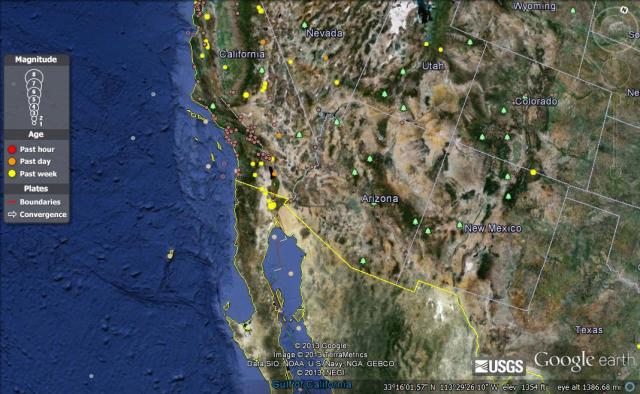
Location: 32.240°N, 115.270°W
Depth: 10 km (6.2 miles)
Tectonic Plate Boundary: Transform “At a transform boundary, two plates slip past one another laterally… In some places, transform faults extend for great distances, occasionally through continental lithosphere. For example, the most famous fault system in the United States, the San Andreas Fault in California, is on a transform boundary. ” (Darell Hess, Physical Geography. 10th Edition, 2011)
Volcanoes
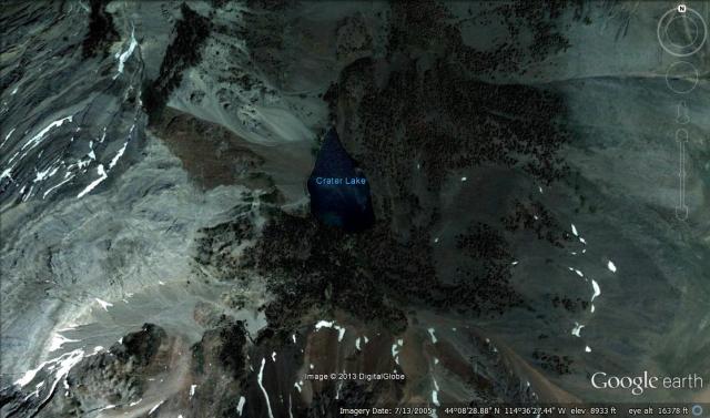
Crater Lake (Idaho, USA)
Volcano Type: Caldera
Tectonic Plate Boundary: Oceanic Continental
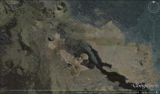
Craters of the Moon (Idaho, USA)
Volcano Type: Cinder Cone
Tectonic Plate Boundary: Hot Spot
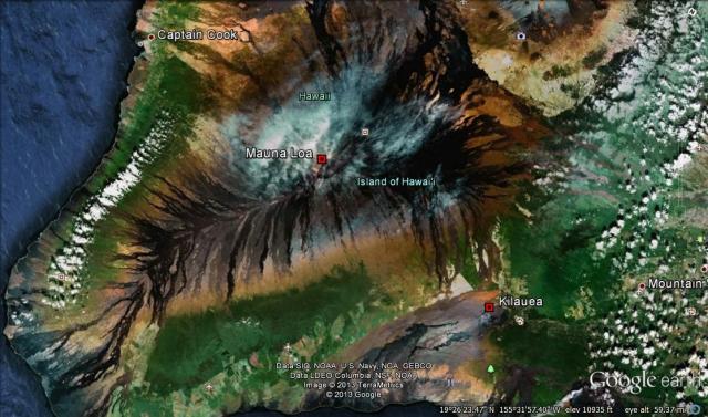
Mauna Loa (Hawaii, USA)
Volcano Type: Shield Volcano
Tectonic Plate Boundary: Hot Spot
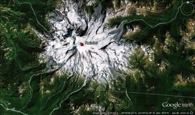
Mt. Rainer (Washington, USA)
Volcano Type: Composite
Plate Tectonic Boundary: Transform
Reflection
Exploring Google Earth was a really interesting experience. When I was looking for earthquakes to examine, I first tried to look at different regions across the globe to see clusters of earthquakes and different sizes of earthquakes. I tried to find earthquakes on each of the different tectonic plate boundaries and some were easier to find than others. Some were easy, especially those that correlated with certain geographic regions. Some of the others were harder to find, like those in the ocean. When looking for different types of volcanoes, some were also easier to find than others. Composite volcanoes and shield volcanoes were much easier to find than cinder cone volcanoes because they looked more like “traditional” volcanoes.”
With programs like Google Earth average citizens now have access to the entire world through their laptop screen. I think it is important that people become more familiar with the political and physical geography of the earth. It can help people better understand their own community and how it relates to others. However, this new access to such detailed information brings up some ethical issues; privacy in particular. Through Google Earth anyone anywhere can now peek into your backyard or take a virtual walk down your street. I think people should be concerned about privacy, but try to balance their concerns with the benefits of this new technology.
